
Fichiér:LocationWesternAfrica.png
Gins de rèsolucion ples hiôta disponibla.
LocationWesternAfrica.png (359 × 359 pixèls, talye du fichiér : 7 Kio, tipo MIME : image/png)

|
Une version vectorielle de cette image existe, dans le format « SVG ». Si elle n’est pas inférieure, elle devrait être utilisée à la place de la présente version pour des affichages en plus grandes dimensions ou nécessitant une meilleure résolution.
File:LocationWesternAfrica.png → File:Africa-countries-western.svg
Pour plus d’informations sur les images vectorielles, consultez la page de transition de Commons vers le format SVG. Voir aussi les informations à propos de la manière dont le logiciel MediaWiki gère les images au format SVG. |
 |
Dèscripcion
| Dèscripcion |
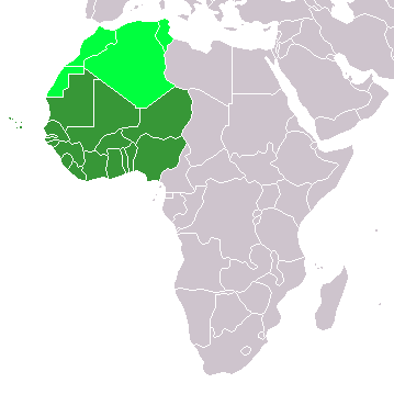
Map: Africa – Western Africa:
|
| Dâta | 4 fevriér 2006 (date de téléversement originale) |
| Sôrsa | La source n’a pas pu être reconnue automatiquement. « Travail personnel » supposé (étant donné la revendication de droit d’auteur). |
| Ôtor | L’auteur n’a pas pu être identifié automatiquement. Il est supposé qu'il s'agit de : E Pluribus Anthony~commonswiki (étant donné la revendication de droit d’auteur). |
Licence
| Mè, lo titulèro du drêt d’ôtor de ceta ôvra, la bèto dens lo domêno publico. Cen s’aplique dens lo mondo entiér. Dens quârques payis, cen pôt pas étre lègalament possiblo ; dens cél câs : Balyo a quint que seye lo drêt d’utilisar ceta ôvra por des fins quintes que seyont, sen gins de condicion, a muens que celes nècèssères per la louè. |
Historico du fichiér
Cllicar dessus na dâta et hora por vêre lo fichiér coment il ére que.
| Dâta et hora | Miniatura | Dimensions | Utilisator | Comentèro | |
|---|---|---|---|---|---|
| d’ora | 11 novembro 2022 a 13:17 | | 359 × 359 (7 Kio) | ColorfulSmoke | . |
| 11 novembro 2022 a 11:56 |  | 360 × 359 (7 Kio) | ColorfulSmoke | ||
| 17 mârs 2018 a 16:47 |  | 360 × 392 (10 Kio) | Maphobbyist | Upload | |
| 31 mârs 2016 a 20:54 |  | 360 × 392 (13 Kio) | Fry1989 | Reverted to version as of 21:24, 9 July 2011 (UTC) | |
| 15 mârs 2016 a 23:24 |  | 360 × 392 (10 Kio) | Hpyounes | new colors | |
| 9 julyèt 2011 a 21:24 |  | 360 × 392 (13 Kio) | Maphobbyist | South Sudan has become independent on July 9, 2011. Sudan and South Sudan are shown with the new international border between them. | |
| 11 dècembro 2007 a 08:09 |  | 360 × 392 (14 Kio) | Hoshie | added Cabinda (Angola) and Montenegro. | |
| 5 fevriér 2006 a 10:55 |  | 360 × 392 (8 Kio) | E Pluribus Anthony~commonswiki | Map: Western Africa, including Maghreb (location) | |
| 4 fevriér 2006 a 19:52 |  | 360 × 392 (9 Kio) | E Pluribus Anthony~commonswiki | Map: Western Africa, including Maghreb (location) |
Usâjo du fichiér
Ceta pâge emplèye cél fichiér :
Usâjo gllobâl du fichiér
Cetos ôtros vouiquis emplèyont cél fichiér :
- Usâjo dessus ab.wikipedia.org
- Usâjo dessus ace.wikipedia.org
- Usâjo dessus af.wikipedia.org
- Usâjo dessus als.wikipedia.org
- Usâjo dessus am.wikipedia.org
- Usâjo dessus ar.wikipedia.org
- ليبيا
- جيبوتي
- موريتانيا
- تونس
- السودان
- الصحراء الغربية
- أنغولا
- أوغندا
- إسبانيا
- تشاد
- النيجر
- مالي
- السنغال
- غامبيا
- غينيا بيساو
- غينيا
- سيراليون
- ليبيريا
- غانا
- توغو
- بنين
- بوركينا فاسو
- الصومال
- كينيا
- تنزانيا
- الغابون
- زامبيا
- موزمبيق
- زيمبابوي
- البرتغال
- الكاميرون
- جمهورية الكونغو الديمقراطية
- بوتسوانا
- جنوب إفريقيا
- جمهورية إفريقيا الوسطى
- جمهورية الكونغو
- سيشل
- ناميبيا
Vêre l’usâjo gllobâl de cél fichiér.